
Norfolk Broads Sailing Map
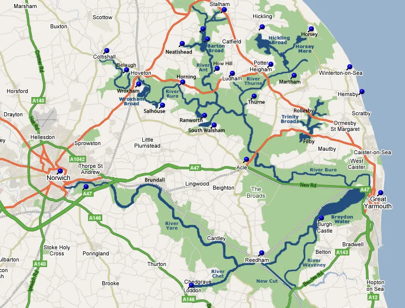
This map gives a basic overview to one of the UK's most captivating and serene inland sailing destinations. The Norfolk Broads are England's largest protected wetland in the heart of East Anglia, a haven for sailors, nature enthusiasts, and adventurers seeking a tranquil escape.
On your sailing yacht will be a copy of Norfolk Broads Waterway Guide, published by collins, which has the most useful Norfolk Broads sailing map. The precise Ordnance Survey maps distinctly indicate key features like moorings, footpaths and boating facilities. They also highlight nearby pubs, shops, and restaurants. The maps come complete with comprehensive navigational notes and informative text detailing the history of The Broads, helping you to unlock the secrets of this picturesque region, allowing you to navigate its winding rivers, discover hidden gems, and embark on a journey through its charming villages and pristine landscapes.
Whether you're sailing on the Norfolk broads for the first time or a seasoned visitor there is always something new to see.
Oliver’s sailing holidays is situated at Martham, at Martham Ferry Boatyard. This is the quiet side of Potter Heigham Bridge, on the Upper Thurne River, near Horsey Broad and Hickling broad on the Northern rivers. Our quiet but central location is a favourite sailing destination for everyone.